I love scripting languages like R, MatLab, Python and Javascript. They are easy to learn and also fast in showing your results. But when it comes to debugging especially R- contrary to MatLab- had its problems with debugging: Finding failures in your code is often not this easy.
Today QGIS 2.0 was officially released and we will come up with several tutorials in the next weeks. First of all: the installation. As we are fans of open source we would like to show you the installation on a fresh build Ubuntu system: Installation on Ubuntu QGIS strongly depends on the grass libraries so as a first step we will install them: As QGIS 2.0 is not part of the official Ubuntu repositories (aka software provider) we need to enhance the list of software providers. Open up the terminal and edit the sources.list which helds this list: Now the…
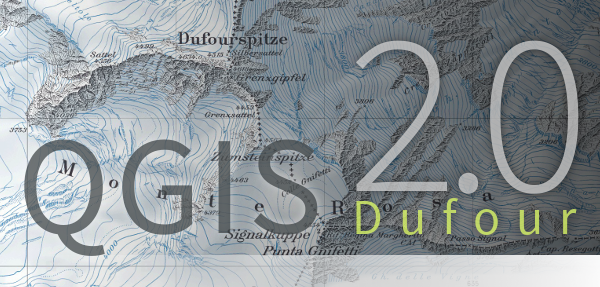
Times are changing and so should a GIS. Since a long time there was the announcement to release QGIS 2.0 to the public by June. But as there were some blockers in the roadmap the release date was not updated. Everyone suspected a release after the QGIS hackathon and during the FOSS4g conference in Nottingham. Now it is out: Updating your ubuntugis-unstable PPA in Ubuntu will now install the brand new QGIS 2.0.1 Dufour! Enjoy and keep on visiting digital-geography!!! But as Nathan Woodrow (@madmanwoo) answered on my Tweet: “@dig_geo_com @qgis @QGISInfo @qgiswatch /sigh the packages aren’t meant to be…
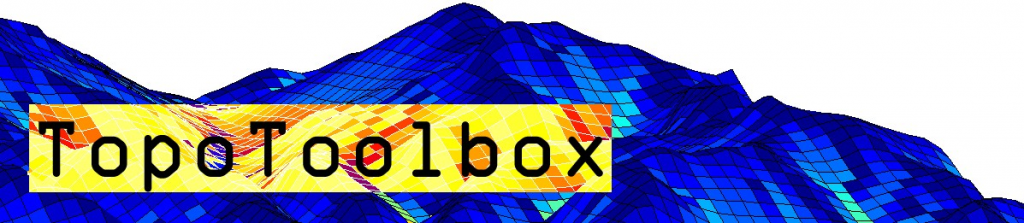
< p align=”justify”>Digital elevation models (DEMs) exist today for the entire globe with consistent quality. Improvements in sensors and data processing give a clue that in the future elevation data will be available in even better spatial resolution and accuracy. Discovering the richness of information inherent in DEMs should thus be supported by good software. Here, I want to give a brief account of TopoToolbox 2, the second version of a MATLAB toolbox for exploring and analyzing DEMs. Dirk Scherler from Caltech and I have been working on many changes to the previous version to make TopoToolbox faster, more memory…
A short time ago I’ve posted an article on the installation of QGIS in combination with a PostGIS database in the background. As we all know, Windows is mostly used as OS on a PC so this is the Windowized version. This is a short summary that sums up the article of a site called Boston GIS. I’ll show you how to install QGIS version 1.8 (which will be updated in some days) and PostgreSQL with PostGIS extension and show you the first steps in the import of shapefiles and raster data.
A lot of you out there are probably working on Windows Systems using ArcGIS and I have to admit that the possibilities with ArcINFO in the background and a proper GDB (GeoDataBase) are really big. But let’s be honest: A lot of your tasks are more or less everyday business, right?! So let us have a look on building a GIS workplace using QGIS 1.8 (which will be updated the big way in some days/weeks) and PostGIS which is a spatial enhancement of PostgreSQL.
Thanks to @seandebasti who enjoyed this year’s “Society of Cartographers Annual Conference” at Staffordshire University who send us a short link on Twitter. The link provides a huge list of 319 freely usable geodata catalogues. Robin who created this list put it on the table via linkedin first and was highly “liked” for this. He covers several topics: Elevation Weather and Climate Natural Disasters Land Cover/ Land Cover Ecology and many more … If you’re interested in his activities you may also want to check Robin’s blog. He blogs about GIS, Cartography and also tutorials with a wide view. You…
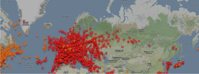
I have to admit that I don’t know since when the Zugradar (train radar) of the Deutsche Bahn (DB) is online, but I found it per accident and I think it’s fun to play around with it. The DB commonly has a bad reputation because of the many delays, so here you can now see how many trains are actually moving and how fast they (sometimes) are. It’s possible to display long-distance trains (IC and ICE) as well as regional trains. Check out the high-speed train from Frankfurt Airport to Cologne, which goes with 300 km/h over almost the entire…
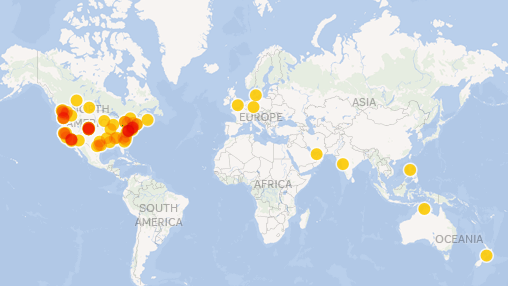
A short time of my day I am watching twitter like others are zapping the TV. A short time ago, there was this list out of nowhere: “the 100 most influencial geospatial people” which was published by OPENGEO. Is it a cultural thing, is the GIS business more developed in the US? So many questions when looking on the map that I’ve made wit the data provided by OPENGEO: SO what about all the people given so much input to QGIS, the spanish guys and so on? I mean the influences are not only coming from selling GIS, right? How…
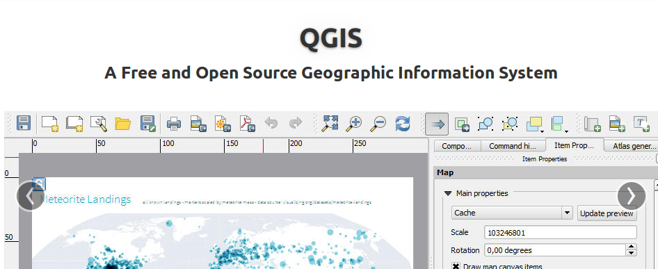
As I came across some posts from @qgiswatch I was very excited as it stated that there are some changes in the GIT of QGIS that looks just like minor changes but in fact we are near the point of an official QGIS 2.0 release. This was somehow confirmed by the comment of QGIS on their facebook page: “The code has been branched for 2.0. We are working on the final bits like change logs, website updates, and docs. A release will follow very soon. Keep an eye out here, twitter, and the mailing lists for the announcement.” (Link). Please…
As Daniel already wrote: There is an awesome tool available online. With geojson.io you will be able to add, edit and remove spatial data used maybe in webmapping application online without using a GIS system anymore. Now I made a little video about the usage.
[jetpack_subscription_form show_subscribers_total=0 title="Newsletter" subscribe_text="Subscribe to our Newsletter and don't miss a post! Tragen Sie sich in unserem Newsletter ein und verpassen Sie keinen Artikel" subscribe_button="OK" ]